Sunday, July 12, 2015

Where on Google Earth v.0.5k (WoGE #500)!

My long dormant blog has come back to life! 

Welcome to the 500th contest of Where on Google Earth (WoGE)! This is the game where we combine our collective love of geology with our obsession (or at least love) with Google Earth(R).

In searching the location for WoGE 499, I heavily relied on the presence of centre-pivot irrigation circles to guide me since only small parts of the globe have these present. Initially I searched North American examples, but nearly everywhere I have found, had these laid out in the familiar square closest-packing arrangement that is a byproduct of the prevailing North American land use system. The arrangement of the centre-pivot irrigation system used in Felix’s contest #499 however, are hexagonal closest-packed. I still remember my packing arrangements! So that led me initially to the Atacama Desert in South America, but unsuccessful with that, quickly moved to northern Saharan Africa then on down to South Africa where I found the Barkly West locality by following a river. I basically played “desert centre-pivot tag.”

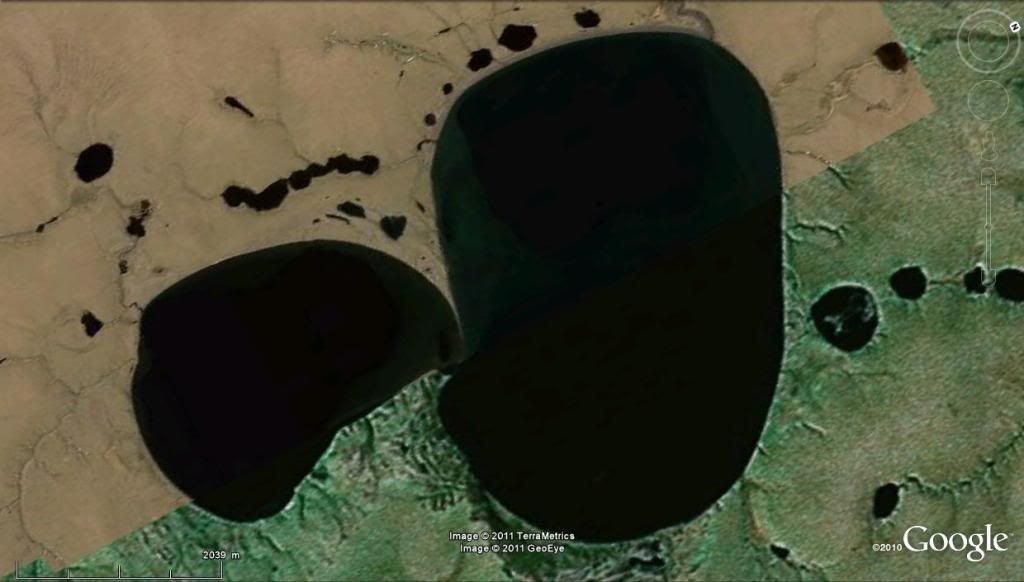
Moving on to my challenge to the WoGE community: This 500th rendition of WoGE does not have the benefit of centre-pivot irrigation circles, but nonetheless does have the benefit of some cool geology. Please locate on Google Earth(R) the following mystery featured in Figure 1.  Rules and specifics after the jump.

Figure 1: WoGE #500 entry. Where is this and what is its geology? Note the north arrow at the bottom-right.


Veterans of this game know what to do, but for the benefit of newcomers, the basic premise (detailed here) is that a screenshot or image derived from Google Earth is posted by the winner of the previous round and your task is to find “Where (precisely) on Google Earth” the image is from. Once you find it, you put in the comments section the specific location and a brief synopsis of its geology and/or geologic significance.

Specifically, to win this round: please post, in the comments section below, the following information:

  1.  Location, in either:
    1. Lat-Long; or
    2. Distance and bearing from any nearby ( <30 km) labeled towns or outposts, including province, state or territory information; or
    3. Geographic name of feature and what province, state or territory its located in.
  2. A brief synopsis of the geology of what is shown. This may require some cursory fact-finding on the internet.

The first person who answers correctly is the lucky winner of this round! As a prize, the winner gets:

  1.  Immense satisfaction that they have earned their place in WoGE history by winning WoGE #500; and
  2. Gets to host WoGE #501 on their blog or ask someone if they can guest-host WoGE #501 on their blog; then
  3. Post a link to their WoGE #501 challenge -- once ready -- in the comments section of this post to maintain the chain of links.
For this round, sensing this WoGE contest will be particularly popular due to it being the 500th, I am invoking the “Schott Rule (SR)”, which means those who have won at least one of the past 499 WoGE contests must wait one hour after "posting time,"shown below, to give those who have not won or those who are new a fighting chance.

If there is no winning response within a few days, I will post a hint in this space. 

Good luck . . . happy Google Earth-ing . . . and I hope all your weekends are going good! :-)

Prosper!

~Cole K.

Posting time:  July 12th 2015   09:00 PDT    12:00 EDT    16:00 UTC    17:00 BST    18:00 CET


SR Expires:   July 12th 2015    10:00 PDT    13:00 EDT    17:00 UTC    18:00 BST    19:00 CET

Friday, January 18, 2013

"Ten Hundred Words of Science": my research in simple English


Hi Readers!

Jumping on a very long caravan of bandwagons, I thought I would introduce the subject of my PhD project using only words from the 1000 most commonly-used words in the English language (try it for yourself using the Up-Goer 5 text box!) Many members of the geoblogosphere, myself inspired by Professor Anne Jefferson's post, have contributed their job descriptions and study subjects using only the 1000 most common used words in English. A Tumblr page entitled “Ten Hundred Words of Science” created by Anne Jefferson and Chris Rowan aggregates meme submissions quite nicely and was an eye opener for me.

Because I study Large Igneous Provinces (LIPs) in general and the High Arctic LIP in specific, doing so was quite the challenge. Words like “mantle “ and “plume” as well as “igneous” and “province” along with “analyze” and “geochemistry’ are not allowed for this meme exercise. I had quite the challenge in front of me as a result, but participating in this meme has actually forced me to think about how to explain my subject matter without using highly technical jargon we in the geosciences utter within the discipline. A necessity when trying to explain what I do to interested laypersons. So without further adieu, here is my job description and PhD topic using only the 1000 most common words:


Using the means of people who study people who have done very bad things, I study a big hot thing of rock that came deep under foot a long time ago and went off big, a lot of times during a short time. Other large hot thing of rock that came deep under foot and went off killed animals, changed things and may have helped us live. 

My area of study is in a very cold place at the top of the big round rock we live on. Its one of the least understood area of rocks formed by a large hot thing of rock that came deep under foot. Using the things I learn, I then tell people about it during talks and writing papers.

As Paul Harvey would say: "and now you know . . . the rest of the story"!

Have a good weekend!

~Cole K.

cc #upgoer5

Sunday, December 18, 2011

Carbonatite lavas of Ol Doinyo Lengai --with the actual movies this time!

I  Finally figured out how to embed YouTube clips! The original version only showed complicated html coding, so I deleted that. Now back to the show:

Hello readers!

A short (I have exams to proctor and grade) blog update to post some cool YouTube fottage of Ol Doinyo Lengai in Tanzania Africa and its unique eruptions of caronatite lavas. Whereas 99.9% of of lavas that are issued worldwide is modeled based upon the silica [SiO4] tetrahedra, carbonatite is principally composed of carbonate minerals. Dawson and others (1990) documented abundant phenocrysts of the rare alkali carbonate minerals nyerereite an gregoryite while noting the conspicuous absences of any major silica phase during the November 1998 activity. The temperature of these lavas are quite low during effusion: less than 600°C, (Dawson et al., 1990)!

Enough of mew talking: click on the film clips below and try to convince yourself that you are seeing competent lavas and NOT muds oozing, flowing or burping out of the volcano!

Small roiling lava pond:


Carbonatite lava channel:


Carbonatite spattering:


Reference:

Dawson, J.B., Pinkerton, G.E., Norton, G.E., Pyle, D.M., 1990. Physiochemical properties of alkali carbonatite lavas: Data from the 1988 eruption of  Oldoinyo Lengai Tanzania: Geology, 18, pp. 260-263

Saturday, December 10, 2011

Accretionary Wedge #41: My response

Im Back!


Ron Schott over at Geology Home Companion is hosting the 41st round of the Accretionary Wedge, where he wants participants to describe the most memorable geologic event that one has experienced. What follows is my contribution:

For my grade 10 Social Studies class, one of the requirements thereof was to write a paper about some culture. I chose to write about the Maori people of New Zealand. One class period was reserved to work on the report in the computer lab while the teacher roamed around, in case students needed help. I, on the computer just as you walk inside the lab and a hare to the right, asked the teacher to come over for help with ideas as I was experiencing writer's block. We had a great discussion and bounced ideas off each other for several minutes, when it happened.

What happened, exactly? The setting was a high school in Beaverton, OR (a southwestern suburb of Portland) on the afternoon of February 28th, 2001. If the date and location sound sort of familiar, I am referring to the M6.8 Nisqually Earthquake that struck the Pacific Northwest. The hypocentre of the earthquake according to the Pacific Northwest Seismic Network's data page, was situated 52 km at depth with the associated epicentre ~18 km NE of Olympia.

This earthquake was my first earthquake I have felt in my life at that point and so for the first few seconds, I wasn't sure what was going on. The ground started rolling like broad waves and confusion amongst my fellow students and the faculty present in the computer lab was quite evident. The earthquake itself lasted, I venture, 15-30 seconds and fits most closely to a III or IV on the Modified Mercalli Intensity scale where I was located at the time.

A few second's after the shaking stopped, the Principal of the school along with the campus safety person stepped foot in the computer lab and announced "May I have your attention? For your information, yes we did experience an earthquake. Please duck and cover," or something to that effect. What occurred soon after the duck-and-cover exercise I cannot recall, but I do believe we were let out of school early and in my case went home and  watched the news reports on the damage to the Puget Sound area while talking to my parental units about our collective experiences. An event I will never forget.

~Cole G. Kingsbury                  

Thursday, May 19, 2011

First Pics from the Field

 Hi Readers!


Well after a few days of resting following a 15 day whirlwind geology field excursion around eastern California and Nevada, (with a fleetng stop in Arizona) here are some pics I have taken. This first batch largely focuses on the Mono Basin and Long Valley of eastern California. We were going to stop at Obsidian Dome to look at "my baby" but nearby Mammoth Mountain recieved 600 inches of snow this winter, apparently double the usual amount according to the person that does reservations in Mammoth Lakes. Mammoth Mountain was mantled with thick snow cover and skiers were still carving crisp turns on the slopes. Needless to say, Obsidian Dome, (and the road leading to it) was still coloured white. In late April. I was scheduled to do my  talk regarding the geology of Obsidian Dome in front of my travel mates while on Obsidian Dome, but Panum Crater had to suffice as an imposter. How do you spell "dang"?


That said and done, here are some pictures from the first couple of days on the trip, Map for geographic reference:

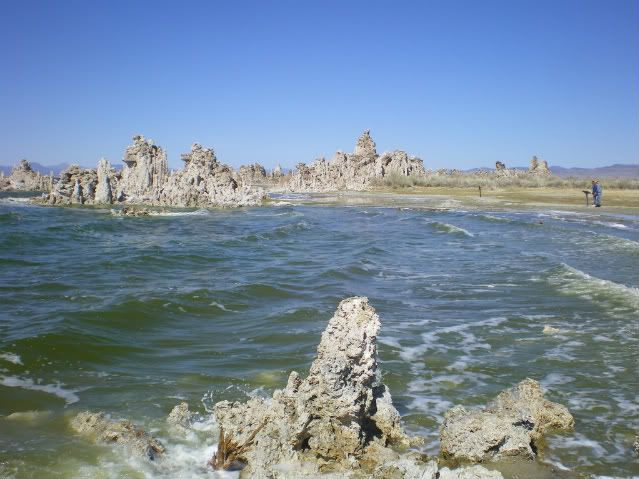
The famous tufa spires on the south shore of Mono Lake, California

Large spherulite in Obsidian from the Glass Mountains (NE margin of Long Valley Caldera)
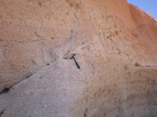
Nice reverse fault cutting the distal, non-welded Bishop Tuff exposed at an abandoned pumice quarry just north of Bishop.
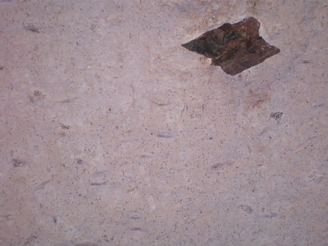
Nice photo showing densly welded, more proximal facies of the Bishop Tuff exposed in the Owens River Gorge. Note the nice wisps of flattened pumice, or "fiamme."This was slightly overhanging so, in order to show scale, I faintly denoted 1 cm to the lower left of the large angular lithic clast, near the centre of the image.
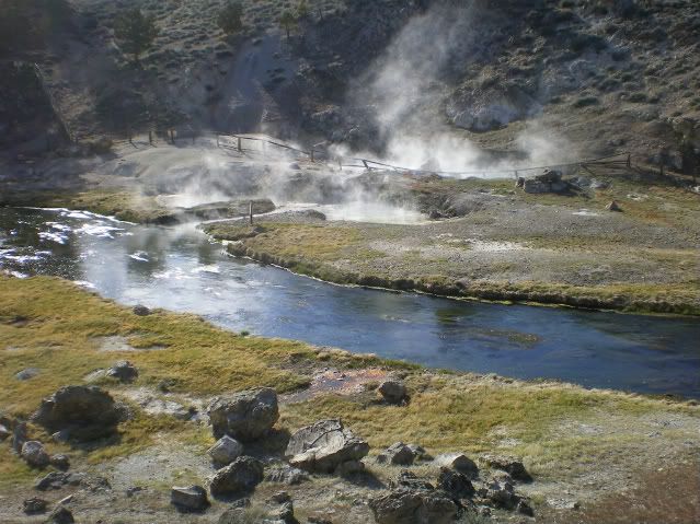
View of the Hot Creek Geological Area. Ahhh the sight of hot springs and fumeroles and the sweet smell of volcanic perfume is a nice way to end a day of geotripping. :-)
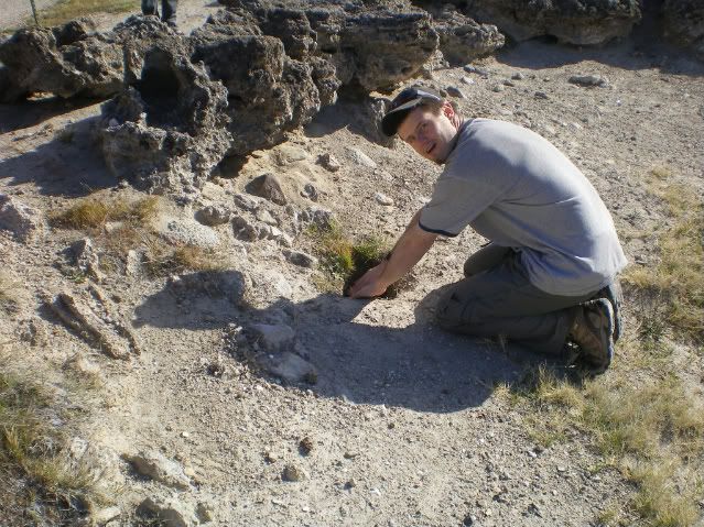
Yours truly warming his hands in "Handwarming Fumerole." Informally named by me thanks to the nice handwarming qualities of this particular fumerole. The temperature outdoors was kind of nippy at the time, but not too bad. Handwarming Fumerole was far from scalding in temperature.
Hope you enjoyed these photos, and I'll post a second batch in the next few days.

Untill nxet time: Prosper geologically!

~Cole K.

Above photos (c) 2011 by Cole Kingsbury

Thursday, April 21, 2011

Getting ready for a geological adventure

Hello readers!

Its been quite some time since I have posted to my Chaotically flow banded blog so I think its time for an update:

Tomorrow, I will be departing Ottawa, Ontario for the deserts of the American southwest to partcipate in a 15-day advanced field studies course offered by Carleton University (I am one of only two University of Ottawa Students attending this trip). This field couse will examine the many volcanic and structual features which make Nevada and adjacent parts of California scenery so spectacular. What follows is a brief outline of where the field course will be headed

  • 23 April:           Meet in Reno, Nevada
  • 24-26 April-:    Mammoth Lakes area to examine Long Valley caldera and Mono basisn
  • 27 April           Enroute to Beatty, NV, look at Big Pine volcanic field andDeath Valley geology
  • 28 April           Spend entire day analyzing the geology around the Yucca Mountain, NV area and discuss nuclear storage implications. Sojourn in Boulder City, NV for 3 nights. 
  • 29 April:          Look at the Searchlight Pluton near Searchlight, NV (South of Las Vegas)
  • 30 April:          Tectonism of the Basin and Range-Colorado Plateau transition near Lake Mead, NV/AZ.
  • 01 May:          Tour Hoover Dam. Drive to Lo$t Wage$ for a day off -- where your's truly will NOT touch a slot machine!
  • 02 May:          Back to geology. Drive north towards Austin, NV, stopping at the Tonopah Mining Museum. Stay 1 night in Austin, NV.
  • 03 May:          Examine the tilted Tertiary Caetano Caldera in Lander County, NV. Stay in Battle Mountan, NV, (so-called the "Armpit of the Nation" by the Washington Post) for 3 nights.
  • 04 May:          Volcanology of the Fish Creek Mountains caldera and the Buffalo Valley volcanic field.
  • 05 May:          Basin and Range tectonism around Battle Mountain
  • 06 May:          Drive Back to Reno for the inevitable end of the field trip.


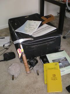
Nearly all packed and ready to go! Included, but are not going back to their homeland are two samples of Bishop Tuff which are nicely camouflaged with the carpet.

One Aspect I am particularly looking forward to is going back to Obsidian Dome which is the subject of my thesis. I have become so attached to that dome during my initial field work that I have nicknamed it "my baby." I am scheduled to make a presentation to the trip participants on the emplacement history and structural controls which influence the location of Obsidian Dome.       

I will try to post pseudo-daily updates to this blog, as well as an image taken during time in the field that day. Free wi-fi at the various hotels and motels helps matters greatly!

I am psyched!

~Cole G. Kingsbury

Above photo (c) 2011 by Cole Kingsbury

Monday, February 14, 2011

My Geo-Valentine's Day blogCard

Greetings readers!


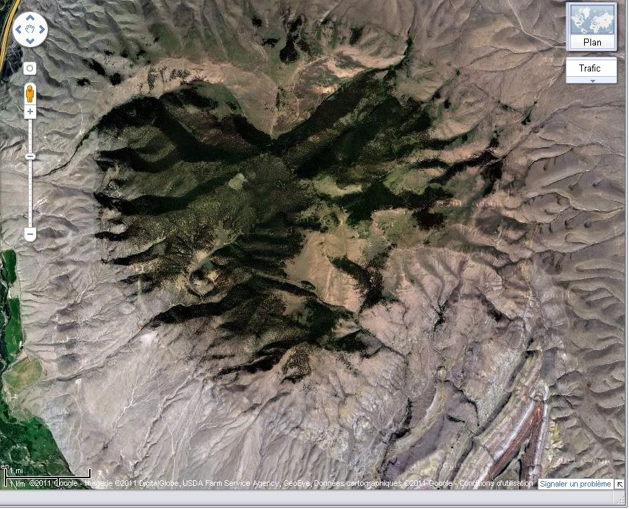
From my road-side outcrop to yours, I wish all of my geoscience friends and bloggers a happy Valentine's Day. A Valentine's Day geologically speaking cannot be without displaying a screen-shot of the McCartney Mountain area of Beaverhead county, Montana from Google Maps.

Screen-shot from Google Maps

Again, happy Valentine's Day to all, and to all a pleasant day!

~Cole K

Tuesday, February 8, 2011

Interesting Igneous Image (I^3) #2: Bishop Tuff

To prime me for more thesis writing, I hereby bring you the second installment of my Interesting Igneous Image series.


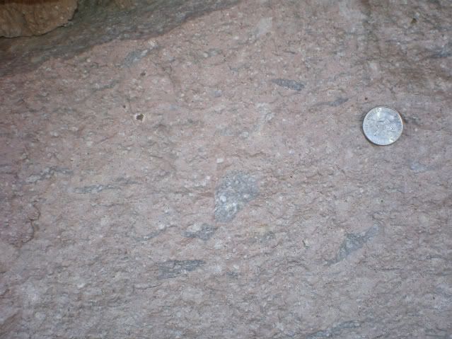
This particular photo is of the densly-welded facies of the ~760 ka Bishop Tuff in the Owens River Gorge. Coin for scale. The stretched wispy dark-grey domains are collapsed pumice, sometimes called "fiamme," Italian for "flame." Fiamme occur when pressure from above and insulating heat within an advancing pyroclastic flow work to collapse the fragile bubble-walls of pumice fragments. Sometimes pyroclastic flow deposits display evidence of rheomorphic behaviour. A "rheomorphic tuff" can be found in the interior of some pyroclastic flows and are a result of being able to flow like coherent lava after being initially deposited as a hot, turbulent incoherent mixture of clasts, pumice and ash.   


Here are some links relating to the Bishop Tuff (2 blogs and two research articles).

NOVA Geoblog, by Callan Bentley

Rhyolitic Magma Based on Melt and Magnetite Inclusions and Zoned Phenocrysts (Journal of Petrology article by Anderson et al., 1999)

Columns: Not just for basalt anymore  Eruptions blog post by Erik Klemetti  

Ring-fracture eruption of the Bishop Tuff  (GSA Bulletin article by Hildreth and Mahood, 1986)  


Enjoy and post remarks if you wish!

~Cole


Above photo (c) 2010 by Cole Kingsbury
   

Friday, January 28, 2011

Where on (Google) Earth -WoGE #260

Many thanks go to Brian Romans of Clastic Detritus for starting this game four years ago!

WoGE #259 was fairly straightforward considering I took a glacial and periglacial geology course during my udergraduate education at the University of Alaska Fairbanks. As a gradutate of an arctic university, I was exposed constantly to the elements of periglacial geology including thermokarst features and thaw ponds. Thus, I am quite famillar with arctic geology and geography. All I really had to do was find a piece of arctic coastline that was smooth and NE-facing. Luckly, WoGE #259 was on my side of the globe (where I started my search).   

As victor of WoGE #259 the torch is hereby passed, and I get to set up the next challenge in "WoGE Wonderland." Thus, here's WoGE #260. Veterans know the rules, but for newcomers, here is how the game is played:

  1. Analyze the screen-capture (at the bottom of this post), and see if you can find where it is by using Google Earth.
  2. Write your answer as a comment to this post describing (a) the location (lat-long and/or specific locality) and (b) a sentence or two about the geology depicted in the image.
  3. The first person to correctly identify specific local and general geology of the image gets to host WoGE #261 on their geoblog – or create a geoblog and then host WoGE #261.
Because much of the globe is in weekend-mode and me feeling quite generous, the Schott Rule is dispensed with for this round. This means veterans and newcomers can immediately dive in to solve this puzzle. Though this rould will probably be solved in relative short order, I will add a hint if this isn’t solved in a couple of days.


Figure for WoGE #260. Click on image for a larger version.


Happy hunting, and have a great weekend!

~Cole K.

Thursday, January 27, 2011

The interview CNN should have given (but didn’t)

The geobloggosphere is currently abuzz over an interview of Dr. Michio Kaku, a highly respected physicist, during a taping of CNN's American Morning show. The subject matter is the Yellowstone Caldera, the likelihood of a super-eruption at Yellowstone in the future and the societal effects should it erupt in our lifetime.  Dr. Erik Klemetti and Gareth Fabbro, both geologists, make eloquent statements in their geoblogs regarding the nature and content of the interview. I am not going to rehash what transpired other than to say CNN has gravely mis-served the public interest by casting a physicist as an expert in geological processes.

Probably one of the most well-respected geologists when it comes to the geology of the Yellowstone Caldera and its eruptions is Dr. Jake Lowenstern, Scientist-in-Charge at the Yellowstone Volcano Observatory. What follows is an interview he gave a couple of years ago and touches on many of the different aspects regarding Yellowstone including eruptive history, hazards, the geothermal system, and the YVO itself. Sure it’s not as dramatic or attention-grabbing as the CNN interview was, but it’s the content that counts, not the drama behind it.


 Yes! Yellowstone is a Volcano (1 of 3)


 The Yellowstone Volcano Observatory (2 of 3)
 

 Yellowstone Eruptions (3 of 3)


All three videos are from "ocweb," USGS's first Youtube channel prior to its move here..


Friday, January 21, 2011

Interesting Igneous Image (I^3) #1

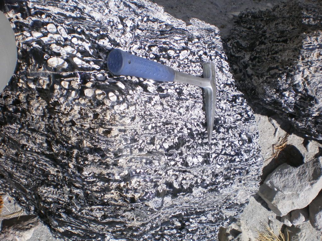
Inspired by fellow geoblogger Brian Romans (of Clastic Detritus) who provides impeccable examples of geology in his Friday Field Photo series, I plan to post one image weekly that I think illustrates interesting igneous geological processes and products. Thus, I kick off my Interesting Igneous Image series with my inaugural image:

   
This image was taken near a pumice mine on the eastern flanks of the Mono Craters chain near June Lake, California. It is of an obsidian chocked-full of spherulites. Spherulites consist of radiating fibres of K-feldspar and quartz (or a high-T polymorph) from a nucleus. This particular rock contains spherulites which have underwent varying degrees of deformation, suggesting a complex relationship between spherulite growth and deformation. Some sphrulites are stretched to the point that they even define flow bands! For more information on the technical details as to how spherulites form, Lofgren (1971) provides an interesting read.

Have a great weekend everyone!

Reference
Lofgren, G. (1971), Spherulitic Textures in Glassy and Crystalline Rocks, J. Geophys. Res., 76(23), 5635–5648, doi:10.1029/JB076i023p05635.  

Photo above (c) 2010 by Cole Kingsbury

Friday, January 14, 2011

Where on Google Earth v0.25K (i.e. #250)!

Hello Geo-enthusiasts!

I hereby present to all of you Where on Google Earth (WoGE) #250. That means we are a quarter of the way to WoGE #1,000! Will we get there? No one really knows – I sure hope we do! If the past rate of WoGE challenges holds in the future, we should be solving WoGE #1k on or about the year 2023. Many thanks go to Brian Romans of Clastic Detritus for starting this game four years ago!

WoGE #249 looked tricky at first, and I thought for a moment that it was somewhere east of Los Angeles, but then I noticed that agricultural fields on the valley floor are not consistent with North American practices in reference to property boundaries. Also the general structural “grain” for much of North America (sans Alaska) is broadly north-south. So I focused my energies elsewhere. In all actuality, WoGE #249 would have been solved much sooner had I done more than a once-over of the North Anatolian Fault Zone. D’OH!

As victor of WoGE #249 the torch is hereby passed, and I get to set up the next challenge in the WoGE conga-line-of-fun. Thus, I am pleased to offer WoGE #250. Veterans of this game know the rules, but for the benefits of newcomers to WoGE, here is how the game is played:

  1. Analyze the screen-capture (at the bottom of this post), and see if you can find where it is by using Google Earth.
  2. Write your answer as a comment to this post describing (a) the location (lat-long and/or specific locality) and (b) a sentence or two about the geology depicted in the image.
  3. The first person to correctly identify location and general geology of the image gets to host WoGE #251 on their geoblog – or create a geoblog and then host WoGE #251.

Since this round is more challenging than the last one I did (WoGE #245) of Plymouth, Montserrat (I think), the  Schott Rule is dispensed with for this round. This means veterans and newcomers can immediately dive in to solve this problem. I will add a hint if this isn’t solved in a couple of days.


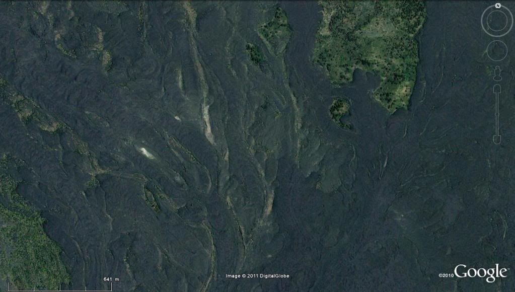
Figure in association with WoGE #250: Click on this image to see a larger version.

 
Happy Searching, and happy weekend!


 ~Cole K.


Thursday, December 30, 2010

Where on Google Earth-- New Year's Eve ed. (also #245)

Hello readers and happy new year!

Welcome to “Where on Google Earth" (WoGE for short). WoGE was started by Brian Romans (then blogging as “…or Something” and now as Clastic Detritus) in January of 2007 and is now close to entering its fourth year of geological adventure – virtually at least. I had fun with WoGE #244 as it was an adventure down the East African Rift. Coupled with the hint given by fellow geoblogger Andrew Alden (over at about.com), I raced over to eastern Africa, followed the rift valley north to south until I got to Lake Malombe with its sine-curve-shaped west shore. As a newcomer to this game myself, WoGE has allowed me to travel the virtual globe to parts that I probably would not have been to otherwise. Yeah, I'm busted! 


As victor of WoGE #244 the torch is hereby passed to me, and I get to set up the next WoGE challenge. Thus, I am pleased to offer WoGE #245. Veterans of this game know the rules, but for the benefit of newcomers to WoGE, here is how the game is played:

  1. Analyze the screen-capture (at the bottom of this post), and see if you can find where it is by using Google Earth.
  2. Write a comment to this post describing (a) the location (lat-long and/or specific locality) and (b) a sentence or two about the geology depicted in the image.
  3. The first person to correctly identify location and general geology of the image gets to host WoGE #246 on their geoblog – or create a geoblog and then host WoGE #246. Extra kudos if this challenge is solved before the year runs out!

Since this is a fairly straightforward challenge despite the small area pictured (I think), and to allow for WoGE newcomers a chance to get into the action, the Schott Rule is hereby invoked. Under this rule, previous winners must wait one hour after the contest starts to answer. 


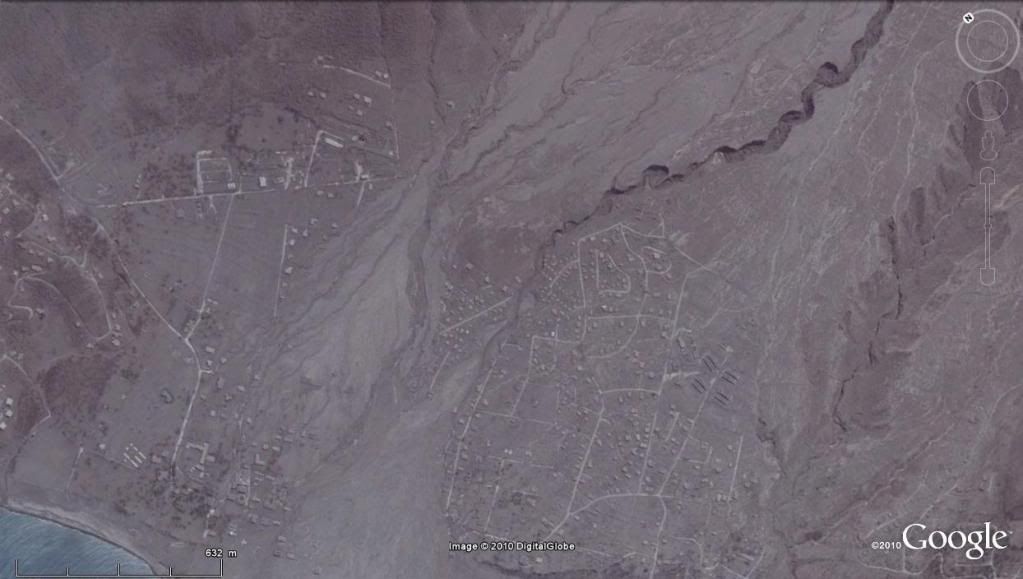
 Figure for WoGE # 245. Click to see a larger verson. This may be the first WoGE challenge using Google Earth v.6

Good luck, happy new year, and I'll see you in 2011! :-)


Posted on December 31st at 9:05 AM PST

Tuesday, December 21, 2010

End of Semester Wrap-up


Greetings readers!

After a couple of weeks or so taking care of wrapping up the fall semester, I have embarked on winter vacation in my other home near Portland, Oregon --Whew!. While my thesis field area is in the eastern Sierras of California, I think its time that I post some geologically noteworthy photographs in the area where I spend most of my time, in the National Capital Region of Canada. These photographs were taken on fieldtrips as a part of an introductory geology course that I was honoured to serve as a teaching assistant.


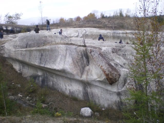
Glacially-carved “rat-tail” near the Cantley Quarry, north of Gatineau, Quebec. A relatively resistant xenolith within less resistant marble (both of Grenville affinity) provides good information regarding the trajectory of glacial ice movement from the Laurentide Ice Sheet. In this photo, the ice moved right-to-left.


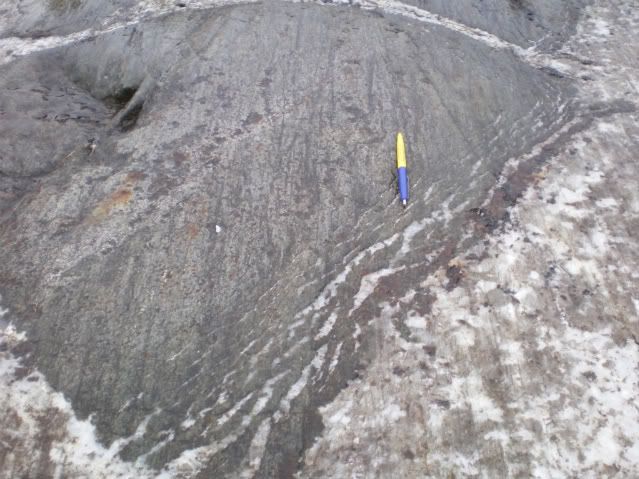
Glacial striations in both the xenolith and the enclosing marble from the Cantley Quarry. The right-margin of the xenolith resembles “slicken-fibres.” Unsure if it was from the glaciations or from the Grenville orogeney (thoughts?) Yellow-part of the pen points in the direction from where the ice flowed.


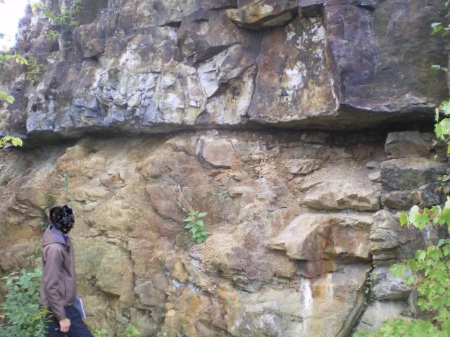
Photo showing an unconformity between the Precambrian Grenville gneiss, below and the Paleozoic Nepean Sandstone above nearby. The gneiss is ~1 Ga (billion years old) whereas the Nepean sandstone is ~500 Ma (million years old). Thus, about a half-billion years of earth history in the Ottawa Valley is missing. Photo was taken beside a road in Parc Lac Beauchamp in Gatineau, Quebec.

Have a great holiday!

All photos (c) by Cole Kingsbury

Friday, December 10, 2010

Flow Banding: A Short Primer (also my first crack at research blogging)


Happy Weekend everyone!

Because the title of my blog is “Chaotically Flow-Banded,” I think its high time that I blog about, you know, flow banding! Flow banding is a pervasive feature that can be found in many different lava flows and domes throughout the world. Because of this fact, they can often be used to characterize the internal structure of many different lava flows as they extruded and then solidified. In other words volcanologists can use flow bands much like how structural geologists use sedimentary successions and metamorphic fabrics to help characterize regional deformation patterns.

But what are flow bands? Simply put, flow bands are rhythmically sequenced "layers" which are distinct compared to adjacent "layers". Flow bands can vary in thickness on scales from a few microns to 10s of centimeters. Banding can be defined in many different ways, however most are not defined by distinct compositional changes between bands, but instead by texture or oxidation states. For example, at Obsidian Dome, where I am currently completing a thesis, flow bands are chiefly defined by microlite densities (see figure below). In other flows like the Mayor Island flow in New Zealand, flow banding is defined by vesicularity (see fig. 5 in Gonnermann and Manga, 2005).

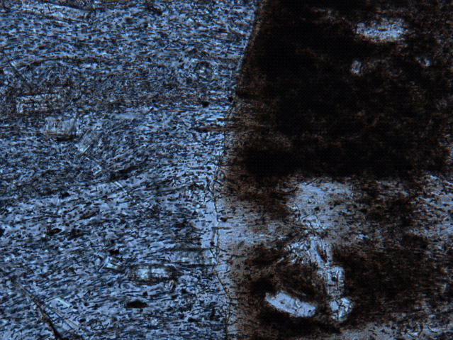
Photomicrograph showing microlite-defined, horizontally-oriented flow banding. Darker bands are denser in microlites. 10x magnification. Brownish feature on right is a spherulite.

Flow-banding is perhaps one of my favourite things to look at in the field and in hand sample – especially when it gets deflected around phenocrysts, as this is beautifully shown below.


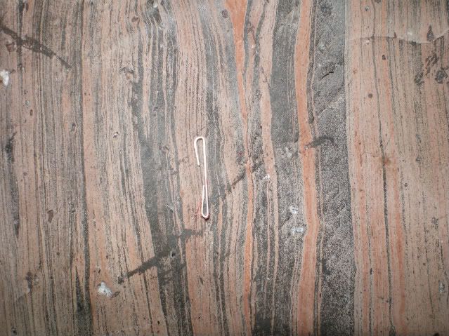
Close-up photo of spectacularly flow-banded obsidian from Obsidian Dome as accentuated by surficial weathering of iron oxide (likely from the microlite-rich bands of ferromagnesian minerals). Staple is ~1 cm wide. To the right of the lower staple hook, flow bands are deflected by a phenocryst.  
 
Have a great weekend, and please comment!
 
Reference:

Gonnermann, H. M. and Manga, M., 2005, Flow banding in obsidian: A record of evolving textural heterogeneity during magma deformation. Earth and Planetary Science Letters, 236 (1-2), p. 135-147.

All photos (c) 2010 by Cole Kingsbury

Saturday, December 4, 2010

Photographic Geology

      One of the amazing aspects of geology is the ability to travel while simultaneously doing a job -- or is it really a job when you have so much fun? Obsidian Dome (and the entire Mono / Long Valley area for that matter) is a volcanic playground replete with compelling sites like Panum Crater , Mammoth Mountain , Hot Creek, and the infamous "CO2 Tree Kill" area at Horseshoe Lake. All of these site -- and more -- are quite photogenic.

      To start off, I will tackle Obsidian Dome, (or as I like to refer to it "my baby" or "the sid"). Since I am studying how Obsidian Dome cooled from phase-observations and textural analysis, it is vitally important to make many observations at the macroscopic all the way down to microscopic scales. Because I had only ~7 days to take field data, I basically had enough time to "skim the surface." Nonetheless, each site I visited has a unique story. I have included three images below that exemplify some of the more interesting patterns found at Obsidian Dome.


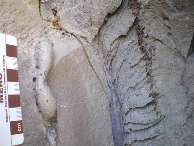
This "drip feature" is interesting. Considering that rhyolite melt is quite viscous, it seems somewhat out of character. On the other hand, and perhaps a more likely scenario, it could be a tight fold which would indicate ductile deformation.


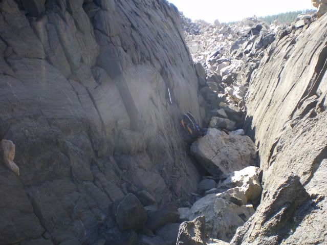
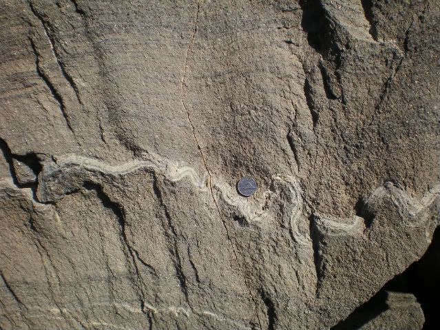
The above two photos are taken from a "crease structure" on Obsidian Dome. The upper photo shows the general scale of the structure (backpack for scale). The bottom photo is a close-up of a particularly interesting feature in the wall of the crease structure, Canadian nickel for scale. Note the disharmonic folding of a pronounced flow band. Flow banding is a pervasive feature of Obsidian Dome among other extrusions, (it is also how I arrived at my blog name). I will touch more on flow banding in a later post. But for now, enjoy these photos, and have a great weekend!

All photos (c) 2010 by Cole Kingsbury


Sunday, November 28, 2010

Entering the Geobloggosphere

Hello readers!

I am an Earth Science graduate student at the University of Ottawa, in the National Capital Region of Canada. Throughout my life I have become fascinated by the raw power we humans bear witness to. It is thus, not surprising, that I have chosen geology as my academic path with a particular emphasis on volcanoes and lava. I earned my B.Sc. degree in geology from the University of Alaska Fairbanks in 2009.

I am currently conducting research on the cooling history of Obsidian Dome near the Long Valley Caldera utilizing field observations and analytical data from the lab. My vision for this blog is twofold:

1. To post particularly interesting stories from news reports regarding volcanic activity, geologic hazards in general and provide my analysis and commentary regarding these,

2. To post my latest musings, thoughts and other interesting items from the field.

As a graduate student, I am understandably quite busy doing research and coursework, so my posting frequency will probably be on the order of 1 to 3 postings per week, depending on my workload.

Enjoy my blog, and please provide feedback!

~Cole K.